+6012-262 0998
info@sanyeong.com.my
Stay Connected
Sanyeong Agricultural Solution
  • Home
  • About Us
  • Products
    • Crop Protection Drones
      • Agras T50
      • Agras T25
      • Agras T20P
      • Agras T10
    • Mission Planning Drones
      • DJI Mavic 3M
      • D-RTK 2 High Precision GNSS Mobile Station
      • DJI Terra
    • DJI SmartFarm Web
    • DJI SmartFarm App
  • Gallery
    • Drone Delivery & Training
  • Career
  • Blog
    • Event
    • News
    • Promotion
Where To Buy
Contact Us
Sanyeong Agricultural Solution
Menu
Click to enlarge
HomeMission Planning Drones DJI Terra
Previous product
D-RTK 2 High Precision GNSS Mobile Station
Back to products
Next product
DJI Mavic 3M

DJI Terra

  • Real-time Mapping
  • 2D Reconstruction
  • 2D Multispectral Reconstruction
  • Real-time 3D Mapping
  • 3D Reconstruction
  • LiDAR Data Processing

READY STOCK
Categories: DJI Terra, Mission Planning Drones
Share
  • Description
Description

Description

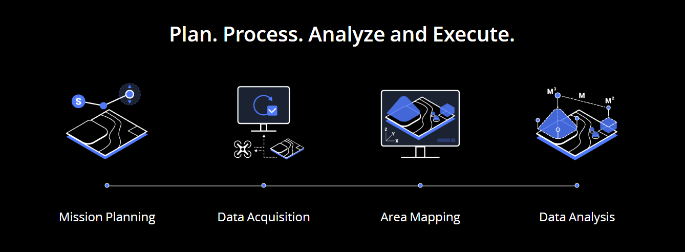
DJI Terra allows users to ‘capture, analyze and visualize’ their environment with easy-to-use mapping software. It was created and designed to ‘help industry professionals transform real-world scenarios into valuable digital assets.’

DJI Terra.PNG

There are multiple use cases for this software, especially those with time-sensitive missions. Use cases include but are not limited to:

  1. Public Safety
    Gather critical on-site information fast.
  2. Construction
    Collect and analyze data across numerous construction projects at once.
  3. Infrastructure
    Perform comprehensive inspections on multifaceted structures easily.
  4. Agriculture
    Gather a better understanding of your fields to generate higher yields.
  5. Filming
    Optimize pre-visualizations better plan across teams and workflows.

DJI Terra allows drone pilots to easily (and quickly!) generated 2D maps while the drone is in-flight and can transform drone data into 3D models and maps for further analysis.

DJI Terra has three mission options:

  1. Area
    Capture a specific area quickly and easily by drawing a custom polygonal flight zone on a map. DJI Terra automatically generates efficient flight path options based on the area selected.
  2. Waypoint
    Create dynamic custom flight paths through an area or around objects using waypoints and adjustable parameters like aircraft altitude, speed, heading, gimbal pitch and angle. For more complex missions that require high attention to detail, the 3D Flight Visualisation feature enables the design and simulation of missions on existing 3D models.
  3. Oblique
    Capture a rich data set by automatically flying the same route multiple times. Each flight automatically adjusts the angle of the camera to capture new details, giving an extra crisp 3D model of the object or asset from multiple angles.

Related products

Close

DJI Mavic 3M

https://youtu.be/4f8NiLApHLk?si=NqzERb6OVbx7LQJE
Close

D-RTK 2 High Precision GNSS Mobile Station

  • Supports: GPS: L1 C/A, L2, L5; BEIDOU: B1, B2, B3; GLONASS: F1, F2; Galileo: E1, E5A, E5B
  • Connect multiple drones to conduct coordinated operations
  • IP65 Ingress Protection
https://youtu.be/3c3I4aW6znU

HQ Office

  • Lot 2973, Batu 8 3/4, Jalan Datuk Kumbar, Kampung Padang, Mukim Tajar, 06500 Langgar, Kedah, Malaysia.

Contact with us

  • +6012 262 0998
  • info@sanyeong.com.my

Social links

  • Facebook
  • Youtube
  • Tik Tok

SANYEONG AGRICULTURAL SOLUTIONS SDN BHD 201601031212 (1202153-M) 2024.
  • Home
  • About Us
  • Products
    • Crop Protection Drones
      • Agras T50
      • Agras T25
      • Agras T20P
      • Agras T10
    • Mission Planning Drones
      • DJI Mavic 3M
      • D-RTK 2 High Precision GNSS Mobile Station
      • DJI Terra
    • DJI SmartFarm Web
    • DJI SmartFarm App
  • Gallery
    • Drone Delivery & Training
  • Career
  • Blog
    • Event
    • News
    • Promotion
  • Contact Us
  • Our 3S Centres (Sales, Service, Spare Parts)
Start typing to see products you are looking for.
WhatsApp Us